places in Salalah
Oman
Salalah
Salalah
Administrative Region:
Dhofar Governorate
population:
155 309
calling code:
+968-23XXXXXX
postcode:
211
Location on the map of Oman
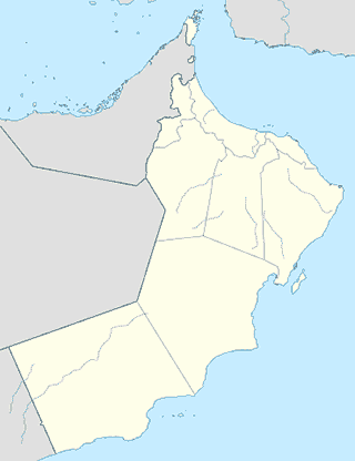
Salalah
Museum
Samahram Tourist Village / Hotel, Salalah, Oman
Al Imam Ahmed Bin Said Street, Salalah
Museum
read more
Museum Salalah, Salalah
Salalah
Museum
read more
The Museum of the Frankincense Land
P.O. Box 129 Mina Al-Fahal, Salalah
Museum
read more
اكشاك النارجيل
Al Ahqaf Street, Salalah
Museum
read more
جمعية المرأه العمانيه بصلاله
Salalah
Museum
read more
Hazrat owais qarni RA
Salalah
Museum
read more
شاطيء الدهاريز
Salalah
Museum
read more
Bus station
محطة باصات نقليات الخليج. GTC
Salalah
Bus station
read more
Gtc Bus Station, Salalah
Salalah
Bus station
read more
National Transportation bus station
Salalah
Bus station
read more
Car rental
Al Rawasi Car Rental
City Center, Salalah, Oman، Salalah Oman
Car rental
read more
Drive Car Rentals
Salalah
Car rental
read more
Al-Maha for car rent
23rd July Street, Salalah
Car rental
read more
Towell Auto Leasing & Trading LLC
Salalah
Car rental
read more
ali salim company
Taqah Bldg, Taqah
Car rental
read more
Shiyas Car Rental
Salalah
Car rental
read more
Color Rent A Car
Salalah
Car rental
read more
MARAHAB CAR RENTAL
Salalah
Car rental
read more
AL ETIHAD CAR RENTAL LLC
Airport Branch-, Salalah
Car rental
read more
Line island Rent a Car
Salalah
Car rental
read more
Union Car Rental
Airport Branch-, Salalah
Car rental
read more
rent a car - bahwan tourism
International Airport, Salalah
Car rental
read more
الصمود لتاجير السيارات
Salalah
Car rental
read more
المقام الملكي لتأجير السيارات
Salalah
Car rental
read more
Europ car rental
Salalah
Car rental
read more
Grocery or supermarket
Smile Supermarket
Salalah
Grocery or supermarket
read more
Library
مكتبة الهداية
شارع النجاح،, Salalah
Library
read more
مكتبة مؤسسة عمان للصحافه و النشر و الإعلان
Salalah
Library
read more
Public Library Book House
Salalah
Library
read more
مكتبة الهداية
Salalah
Library
read more
📑
Salalah all categories
Accounting
Administrative area level 1
Airport
Amusement park
Atm
Bakery
Bank
Bar
Beauty salon
Book store
Bus station
Cafe
Campground
Car dealer
Car rental
Car repair
Car wash
Cemetery
Church
Clothing store
Convenience store
Dentist
Department store
Doctor
Electrician
Electronics store
Furniture store
Gas station
General contractor
Grocery or supermarket
Gym
Hair care
Hardware store
Health
Home goods store
Hospital
Jewelry store
Laundry
Library
Local government office
Locality
Lodging
Mosque
Movie theater
Museum
Natural feature
Neighborhood
Night club
Painter
Park
Parking
Pharmacy
Point of interest
Police
Post office
Premise
Real estate agency
Restaurant
Route
School
Shoe store
Shopping mall
Spa
Stadium
Storage
Store
Supermarket
Travel agency
University
↑