School nearby Modern Nursery
Oman
School nearby Modern Nursery
Modern Nursery
Muscat, Oman
contacts phone
:
+968 9321 1417
Latitude:
23.5935371
, Longitude:
58.3819662
larger map & directions
read more
nearest School
87 m
Al-Bayan Center Athaiba
Muscat
School
read more
294 m
Oranss Kindergarten
Muscat
School
read more
327 m
Agyal Al Huda Private School مدرسة أجيال الهدي الخاصة
Muscat
School
read more
375 m
Osamah Bin Said Private School.
4404 Way, Muscat
School
read more
382 m
Driving School
Al Safat Street, Muscat
School
read more
387 m
Driving School
Muscat
School
read more
499 m
Madrasuthul Islamiya, Azaiba, Oman
Muscat
School
read more
524 m
Azaiba Private School
Muscat
School
read more
566 m
Tunisian school Muscat
Muscat
School
read more
579 m
حضانة الأيادي الصغيرة
Muscat
School
read more
585 m
Little Hands School
Muscat
School
read more
631 m
world skills Training Services عالم المهارات لخدمات التدريب
Muscat
School
read more
662 m
Muscat Autism Center - MAC
Muscat
School
read more
712 m
Al Ghubra Private School مدرسة الغبرة الخاصة
18 18th November Street, Muscat
School
read more
713 m
Assafwah Private School, Ozaiba
4405 Way, Muscat
School
read more
927 m
TLC Oman International Primary School
4494 Way, 1619 House, Muscat
School
read more
993 m
Mathnasium Oman
Muscat
School
read more
1.112 km
American Lyceum International Nursery Muscat
220 b, 18th November Street, Muscat
School
read more
1.138 km
Al Nibrass Private School
Muscat
School
read more
1.15 km
مدرسة النبراس الخاصة
Muscat
School
read more
1.289 km
TLC Oman Nursery School
Muscat
School
read more
1.301 km
TLC Oman International Nursery School
4627 Way, 1619 House, Muscat
School
read more
2.3 km
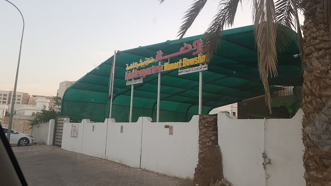
روضة منارة بوشر الخاصة
Al Ghubrah South, Muscat
School
read more
2.486 km
Itlalat ALMajd Nursery
Ghubra South, Muscat
School
read more
2.542 km
Oman Heart Association
Al Ghubrah South, Muscat
School
read more
📑
all categories
Accounting
Administrative area level 1
Airport
Amusement park
Art gallery
Atm
Bakery
Bank
Bar
Beauty salon
Bicycle store
Book store
Bowling alley
Bus station
Cafe
Campground
Car dealer
Car rental
Car repair
Car wash
Cemetery
Church
City hall
Clothing store
Convenience store
Courthouse
Dentist
Department store
Doctor
Electrician
Electronics store
Embassy
Establishment
Finance
Fire station
Florist
Food
Furniture store
Gas station
General contractor
Grocery or supermarket
Gym
Hair care
Hardware store
Health
Home goods store
Hospital
Insurance agency
Jewelry store
Laundry
Lawyer
Library
Liquor store
Local government office
Locality
Locksmith
Lodging
Meal delivery
Meal takeaway
Mosque
Movie theater
Moving company
Museum
Natural feature
Neighborhood
Night club
Painter
Park
Parking
Pet store
Pharmacy
Physiotherapist
Plumber
Point of interest
Police
Post office
Premise
Real estate agency
Restaurant
Route
Rv park, camping
School
Shoe store
Shopping mall
Spa
Stadium
Storage
Store
Supermarket
Taxi stand
Travel agency
University
Veterinary care
Zoo
sublocality level 1
↑